Contact | RSS | EN | DE | EL | ES | FR | IT | RU

Our Volcanoes & Earthquakes App for Android get it here

Updated: May 15, 2024 00:37 GMT -
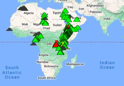
Map with volcanoes and earthquakes
Earthquake list
Filter setting
Detail info about a volcano on the map

About this app

Volcanoes & Earthquakes shows the latest earthquakes and active volcanoes on a map and as list.
You can filter the data shown in various ways, e.g. by magnitude or age of earthquakes, the distance from your location, the status of volcanoes and so on.

The original earthquake / volcano data can be found with more detail on www.volcanodiscovery.com. Earthquake data are continuously being collected and updated from various public sources, mainly international agencies such as USGS, GFZ, EMSC and many others (currently more than 40 sources).

Features

  • See currently erupting volcanoes on a map (more than 1600 active or dormant, plus many older extinct volcanoes)
  • Get most recent volcano news, including volcanic ash advisories (starting from v.1.4.0)
  • Notifications: near-real time earthquake & volcano alerts
  • See the most recent earthquakes around the world based on one of the most complete and accurate earthquake datasets on the internet – earthquakes worldwide up to 7 days old
  • Custom alerts for user-set locations/areas (from v.1.10.)
  • Custom maps along with custom lists (from v.1.11 and 1.12)
  • Listing of earthquakes near active volcanoes (could indicate volcanic unrest)
  • Complete volcano listing worldwide alphabetically/by country/by activity level (starting from v. 1.4.0)
  • Tectonic plate boundaries (major fault zones) (from v. 1.9)
  • Tectonic faults (from v. 2.14)
  • Multiple data sources (more than 40 international and national data sources)
  • Filter earthquakes according to magnitude, age, depth and distance
  • Earthquake statistics - magnitude/energy/depth vs time or magnitude (starting from v. 2.4.0)
  • List quakes by magnitude
  • Indicate whether quakes are under sea or land
  • Filter quakes by continent, country or state (starting from v. 2.3.0)
  • Sort quakes by time (latest) or size (magnitude)
  • Larger earthquakes (above magnitude 6.0) available for up to 1 year
  • Earthquake archive since 2012 - arguably the most complete available on the web (starting from v. 2.3.0)
  • Optional background update at custom interval
  • Alert if earthquakes might have been felt in your area
  • Submit/read/view user earthquake reports on map via the "I felt an earthquake" feature
  • Detailed information about each earthquake
  • Detailed information about each volcano including list of eruptions and manner of eruptions
  • Purpose-built and customized, highly compressed data format to save bandwidth
  • Offline access with cached data
  • Submit a feature request through comments!

Changelog

2 Oct 2023 - Version 2.15.0
- In-App reporting of shaking from possible quakes
- Notification when a quake you reported felt was found

26 Aug 2023 - Version 2.14.3
- maintenance update to android version 33+
- minor bug fixes (depth filter now working again properly)

22 Apr 2023 - Version 2.14.2
- improved display of motion arrows at plate boundaries

7 Apr 2023 - Version 2.14.1
- minor bug fixes

3 April 2023 - Version 2.14.0
- Detailed tectonic plates
- Thousands of active fault lines

18 Mar 2023 - Version 2.13.4
- Optional alternative notification service
- Minor bug fixes

8 Mar 2023 - Version 2.13.3
- Improved update handling
- Internal code updates
- Added Turkish interface

4 Mar 2023 - Version 2.13.2
- Added option to scale circles / volcano icons
- Internal updates

2 Mar 2023 - Version 2.13.1
- Minor big fixes

27 Feb 2023 - Version 2.13.0
- Additional configuration options
- Improved data updates
- Added Arabic and Persian
- Minor bug fixes

23 Feb 2023 - Version 2.12.0
- Additional settings
- Optional switch to use quake list in light mode
- Internal code updates

19 Feb 2023 - Version 2.11.2
- UI improvements
- Bug fixes

17 Feb 2023 - Version 2.11.1
- Fixed minor bug that sometimes showed ads on pro version with 2.11.0
- Internal optimizations

17 Feb 2023 - Version 2.11.0
- Offer Upgrade subscriptions
- Additional settings
- Cleaned up UI

11 Jan 2023 - Version 2.10.0
- Dark mode support
- Cleaned up UI
- Sorting of quakes by user reports
- Various additional configuration options
- Minor bug fixes
- Code updates

8 Jan 2023 - Version 2.9.1
- Minor bug fixes

7 Jan 2023 - Version 2.9.0
- Internal optimizations
- Improved notification handling
- Minor bug fixes

1 Jan 2023 - Version 2.8.0
- Internal updates and improvements
- Minor bug fixes

20 May 2021 - Version 2.7.0
- Updated design
- Added feature to report a quake just felt

21 Apr 2021 - Version 2.6.4
- Improved content for pro users

10 Sep 2020 - Version 2.6.3
- UI updates and internal optimizations

27 Jul 2020 - Version 2.6.2
- Internal optimizations and minor bug fixes

4 Mar 2020 - Version 2.6.1
- Integrated Pleistocene volcano database
- Edit locations directly from quake list (click on header)
- Internal optimizations and minor bug fixes

24 Feb 2020 - Version 2.6.0
- many older volcanoes added to database
- better color contrast for older quake symbols in terrain map view
- additional intuitive UI features
- internal optimizations
- support id for notification testing
- minor bug fixes

(Version 2.5.2 abandoned)

17 Feb 2020 - Version 2.5.1
- internal optimizations
- options for different age classes by colors for quakes on map (pro version)
- bug fixes

9 Feb 2020 - Version 2.5.0
- option to use condensed quake list
- improved notification handling
- internal optimizations
- minor bug fixes

22 Aug 2019 - Version 2.4.2
- remember list / tab preferences
- internal optimizations
- bug fixes

14 April 2019 - Version 2.4.0
- earthquake stats
- option to sort quakes by magnitude (largest first)
- bug fixes

7 April 2019 - Version 2.3.0
- filter quakes by continent or state

29 Mar 2019
- added additional data sources for Brazil (USP), France (RENASS), India (IMD)

26 Mar 2019 - Version 2.2.2
- indicate quakes under the sea
- bug fixes

20 Mar 2019 - Version 2.2.1
- re-enabled use of GPS for location
- logarithmic sliders for distance
- small bug fixes

9 Mar 2019 - Version 2.2.0
- filter by country
- earthquake archive
- internal and UI improvements
- bug fixes

3 Mar 2019 - Version 2.1.3
- option to disable showing of flags in list

24 Feb 2019 - Version 2.1.2
- minor bug fix (added hypocenter depth to list view again)

22 Feb 2019 - Version 2.1.1
- reverse geocoding (detect country of epicenter and indicate with flag)
- cleaned up interface (sliders for distance / magnitude selection etc)
- added list of volcanoes by update

27 Jan 2019 - Version 2.0.3
- custom sounds for alerts again available

(Version 2.0.2 - abandoned)

20 Jan 2019 - Version 2.0.1
- bug fixes

16 Jan 2019 - Version 2.0
- update of messaging API from GCM to FiireBase (google will retire GCM by 11 April 2019)
- lowered location permission precision needed
- run-time permissions that can be revoked any time

25 Aug 2018 - Version 1.12.2
- added Portuguese, Russian and Indonesian
- added BMKG data source
- bug fix (list for custom location was showing own location instead)
- minor UI improvements

19 Aug 2018 - Version 1.12.1
- bug fixes

18 Aug 2018 - Version 1.12.0
- custom maps
- many small features and bug fixes (alert sound etc)
- internal optimizations

31 July 2018 - Version 1.11.3
- minor bug fix when user changes distance unit during session

30 July 2018 - Version 1.11.2
- minor bug fixes
- rename location "Yunanistan" to "Greece" when reported by Istanbul Univ.

27 July 2018 - Version 1.11.1
- bug fixes

24 July 2018 - Version 1.11.0:
- custom quake lists for custom locations
- many internal optimizations

19 June 2018 - Version 1.10.0:
- custom alerts for custom locations
- improved ui
- bug fixes

5 June 2018
- added source INSIVUMEH (Guatemala)

25 Jan 2018 - Version 1.9.5:
- share option
- improved compatibility

9 Dec 2016 - Version 1.9.4:
- filter/show earthquake depth
- upload photos for I-felt-it reports

19 July 2016 - Version 1.9.3:
- maintenance update

20 May 2016 - Version 1.9.2:
- code optimizations
- bug fixes

16 May 2016 - Version 1.9.1:
- map scale bar
- total event count in list
- filter magnitude 7 (for quakes / reports up to 1 year back)
- new navigation modes for some activities
- bug fixes

13 May 2016 - Version 1.9:
- tectonic plate boundaries (major fault zones)
- map settings window
- improved caching & navigation
- significant data bandwidth reduction
- bug fixes

24 Mar 2016 - Version 1.8.4:
- improved data compression for 30-50% bandwidth savings
- server-side improvements to faster process quakes

3 Mar 2016 - Version 1.8.3:
- cleaned up escape character "\" in location names

29 Feb 2016 - Version 1.8.1/2:
- bug fixes (database crash when updating to 1.8)
- lights on/off for notification settings fixed
- A-Z list bottom cut-off fixed

28 Feb 2016 - Version 1.8:
- volcano alerts (notifications)
- code & battery consumption improvements
- minor bug fixes (e.g. distance filter problems when no location available)

9 Feb 2016 - Version 1.7:
- latest volcano update in single view
- Spanish, Japanese and Chinese translations
- minor bug fixes

30 Jan 2016 - version 1.6.4
- German translation
- improved display of volcano list view

29 Jan 2016
- Italian translation - versione italiana

24 Jan 2016 - version 1.6.3
- optional sound with notifications

23 Jan 2016 - version 1.6.2
- push notifications
- bug fixes

21 Jan 2016 - version 1.6.1
- added alert sleep options for night-owls;-)

20 Jan 2016 - Version 1.6:
- earthquake alerts (custom notifications)
- improved code
- minor bug fixes

5 Dec 2015 - version 1.5.2
- show list of earthquakes you might have felt
- color scheme for earthquake list (optional)
- bug fixes

30 Nov 2015 - version 1.5.1
- show alternative data sources for earthquakes where available
- added filter option magnitude 2 for earthquakes
- horizontal scroll enabled for magnitude filter settings in small screens
- direct link to facebook page for comments
- bug fixes

18 Nov 2015 - Version 1.5:
- option to upgrade to "PRO"-version
- improved filters and settings menu
- minor bug fixes

13 Nov 2015 - version 1.4.1:
- added link to volcano webcam tool
- added various data sources (for quakes in Argentina, Serbia, Japan)
- minor bug fixes

9 Nov 2015 - Version 1.4:
- complete volcano lists & infos by name / by country
- earthquake "I-felt-an-earthquake" reports shown on map (optional feature to enable in settings)
- listing of Earthquakes near active volcanoes (optional feature)
- Volcanic Ash Advisory Centers (VAAC) reports for fast lookup in case of ongoing or new volcano eruptions
- minor bug fix (calculation of estimated intensity sometimes went wrong)
- code improvements

3 Nov 2015: minor server-side fix
A small server-side code bug resulted in a short interruption in fetching new earthquakes by the app. Fixed.

25 Oct 2015 - Version 1.3.1 / 1.3.2:
- lowered compatibility requirements
- minor bug fix

24 Oct 2015 - Version 1.3:
- added legend
- improved status bar (showing total nr of volcanoes & earthquakes in database)
- minor bug fixes
- code optimizations

22 Oct 2015 - Version 1.2.1:
- minor fix (faster location service)
- added data source PHILVOLCS (earthquakes in the Philippines)

20 Oct 2015 - Version 1.2:
- added option to auto-update / download new data in background
- small fixes

12 Oct 2015 - Version 1.1:
- include earthquakes >M6 for the past year
- optimized earthquake data download
- improved filter settings
- minor bugfixes (e.g. latitude was taken as longitude in a routine by mistake)

12 Oct 2015
- added earthquakes from IRSC (Iranian Seismological Center, Institute of Geophysics, University of Tehran)
- added earthquakes from CEIC ( China Earthquake Network Centre)

30 Sep 2015
First release (version 1.0)

Discussion & Comments

Comment on our facebook page

Disclaimer

Although we collect data carefully and maintain the application as well as possible, there is no warranty for correctness, completeness, or continuous availability of the information and the functionality of the app or this website.

The Volcanoes & Earthquakes app and our websites have been designed for educational and informational purposes only. We have no governmental affiliation and the information provided should not be used for disaster prevention, decision making, emergency planning or any other critical purposes. We are not responsible for any problems, mishaps or accidents that can arise from using the app or this website.
Get the app on google play store
IOS version for iPhone & iPad
See also: IOS version
Why is there advertising on this site?
Sources: VolcanoDiscovery / VolcanoAdventures and other sources as noted.
Use of material: Most text and images on our websites are owned by us. Re-use is generally not permitted without authorization. Contact us for licensing rights.
Volcanoes & Earthquakes
VolcanoDiscovery Home
Volcanoes | Earthquakes | Photos | Volcano News | App
Adventure & Study Travel
Tours to Volcanoes and Volcanic Areas: walking tours, photo tours, study tours
Tours & Dates | FAQ | About us
Get our newsletter!
Company info
Contact | Legal info | Terms & conditions
Follow us
Follow us on facebook Follow us on Instagram Follow us on Twitter Visit our Youtube channel
EN | DE | EL | ES | FR | IT | RU
VolcanoDiscovery GmbH, Germany, Reg. nr.: HRB 103744, EU Tax Id: DE 297 465 123 owned and created by
Dr. Tom Pfeiffer, volcanologist, volcano photographer, tour organizer member of
IAVCEI
IAVCEI
Vulkanologische Gesellschaft
Volcanological Society
Ecotourism Greece
Ecotourism Greece
RUV insurance
Insured by R+V
VolcanoDiscovery © 2004- All Rights Reserved | Privacy - Cookie Settings